
Seeing the Roads Through the Trees: A Benchmark for Modeling Spatial Dependencies with Aerial Imagery
Caleb Robinson, Isaac Corley, Anthony Ortiz, Rahul Dodhia, Juan Ferres, Peyman Najafirad. "Seeing the Roads Through the Trees: A Benchmark for Modeling Spatial Dependencies with Aerial Imagery." arXiv preprint arXiv:2401.06762, 2024.
We introduce a novel remote sensing dataset for evaluating a model’s ability to learn long-range spatial dependencies in aerial imagery by performing road extraction while containing large gaps occluded by tree canopy.
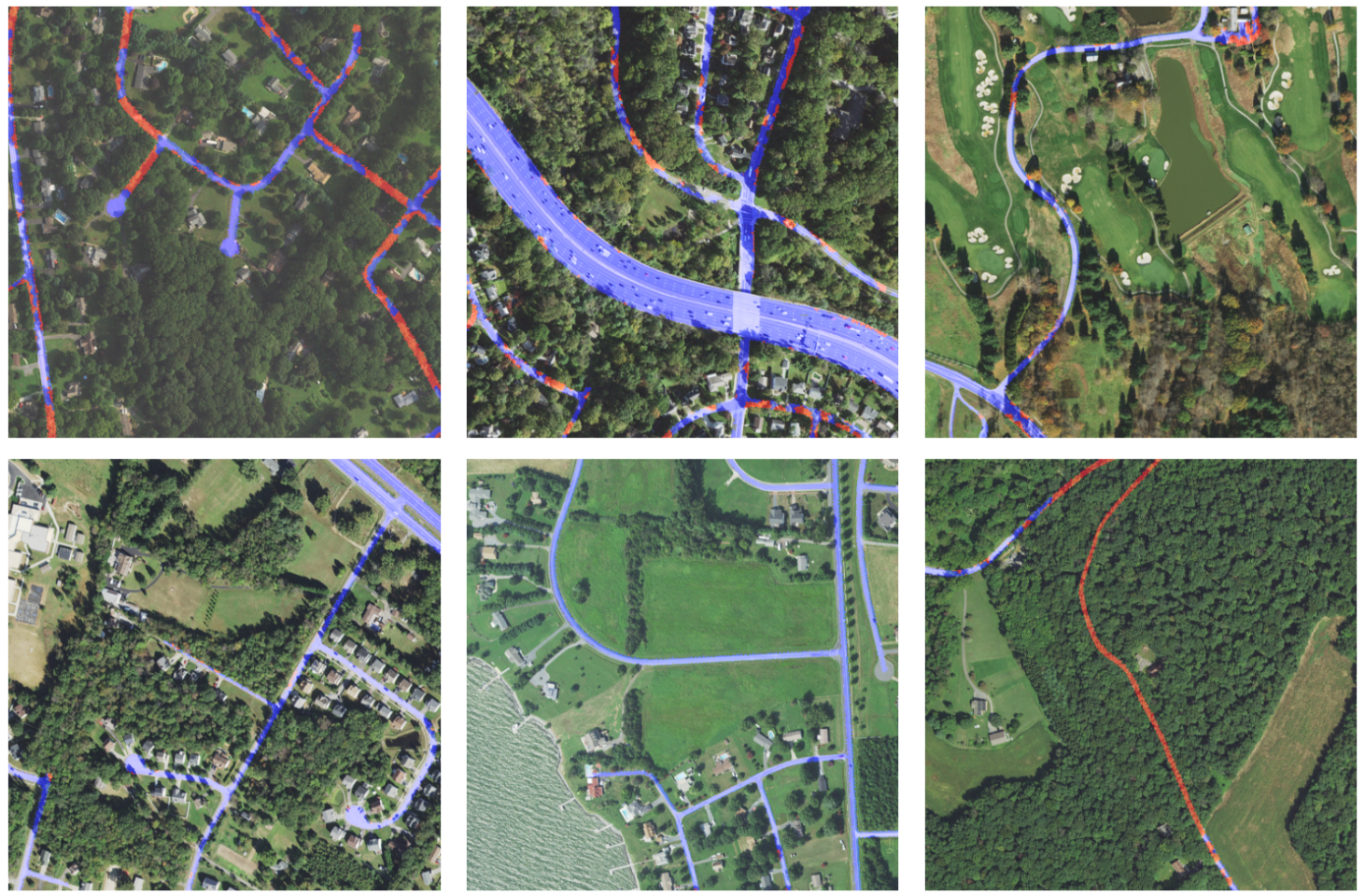
Figure 1.Example images and labels from the dataset. Labels are shown over the corresponding NAIP aerial imagery with the "Road" class colored in blue and the "Tree Canopy over Road" class in red.
Cite as:
@article{robinson2024seeing,
    author = "Robinson, Caleb and Corley, Isaac and Ortiz, Anthony and Dodhia, Rahul and Ferres, Juan M Lavista and Najafirad, Peyman",
    title = "Seeing the Roads Through the Trees: A Benchmark for Modeling Spatial Dependencies with Aerial Imagery",
    journal = "arXiv preprint arXiv:2401.06762",
    year = "2024",
    url = "https://arxiv.org/abs/2401.06762"
}